


All categories >
Where are the eight throat roads of global international shipping (Daquan of international shipping hubs)
Categories:
Time of issue:
2024-03-08 14:59
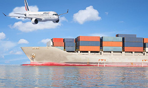
Today, let's briefly introduce the eight most important throat roads in the world.
1. Panama Canal
Suppose we circle the earth from Shanghai to the east, cross the wide Pacific Ocean, and enter the Atlantic Ocean. Of course, the first important thing is the Panama Canal.
The Panama Canal (English: Panama Canal; Spanish: Canal de Panama) is located in the Central American country of Panama. It crosses the Isthmus of Panama and connects the Pacific and Atlantic Oceans. It is an important shipping route and is known as one of the seven engineering wonders in the world. "World Bridge". The Panama Canal was built by the United States and opened in 1914. It is now owned and managed by the Republic of Panama and belongs to the sluice canal. The length from one side of the coastline to the other is about 65 kilometers (40 miles), while from the deep water of the Caribbean Sea to the deep water of the Pacific side is about 82 kilometers (50 miles), the width is 304 meters, and the narrowest place is 152 meters.
Before the Panama Canal, North America, Central America, and South America were seamlessly connected. From the Pacific Ocean to the Atlantic Ocean, it could only be bypassed from the southernmost tip of South America. Obviously, a canal was dug from the narrow section of Central America to open up the two oceans and let the oceans join hands to be satisfactory.
Don't think that the Panama Canal is as old as the Suez Canal. It was actually completed and opened to navigation in 1914. It was built by the Americans and is now managed by Panama. The canal passes through the capital, Panama City, and enters the Caribbean Sea at the northern end of Colon, with a total length of 65km.
Due to the ups and downs of the terrain, the Panama Canal relies on multi-stage locks to adjust the water level to ensure the depth of the river and the passage of ships. The United States has a lot of experience in this area. There are many such locks on the Erie Canal in New York. But as a result, the passage of ships is slower, and from 2024 onwards, the Panama Canal will only be able to pass 24 freighters per day.
Due to the existence of the Panama Canal, freighters from China to the East Coast of the United States can be directly connected via the All-Waterway (ALW-ALL WATER). Although the freight rate is cheap, the voyage is long. Of course, it can also be shipped to the US-West port first, and then transported to the US-East by rail (MLB-MINI LAND BRIDGE). Although the voyage can be shortened by one week, it is not affected by the navigation conditions of the Panama Canal, but the freight rate is relatively high.
(ii) Strait of Gibraltar
Out of the Panama Canal is the Caribbean Sea, continuing eastward, across the Atlantic, with the European and African continents across the front. To cross, you must enter the Mediterranean (Mediterranean Sea). The Strait of Gibraltar between Morocco (Morocco) and Spain is the only way, and the strategic location is obvious.
The Strait of Gibraltar (Strait of Gibraltar) is located between the southernmost part of Spain and northwestern Africa (5 degrees 36 minutes west longitude, 35 degrees 57 minutes north latitude); the narrowest is between Cape Marrochi in Spain and Cape Sires in Morocco, and is only 14 kilometers wide. "Gibraltar" is the English translation.
The Strait of Gibraltar lies between the southernmost part of Spain and northwest Africa. It is an important gateway connecting the Mediterranean and the Atlantic. The narrowest part of the gorge is only 13 kilometers, and the west part of the gorge is the widest, reaching 43 kilometers. The shallowest water depth is 301 meters, the deepest water depth is 1181 meters, and the average depth is about 375 meters. The current from the Atlantic Ocean to the Mediterranean Sea through the Strait of Gibraltar is 4 kilometers per hour. It was used by Atlantic navigators in its early years, and expeditionary fleets from the countries bordering the Mediterranean had frequently passed through it to reach the Atlantic Ocean. Today, the Strait of Gibraltar remains an important Atlantic waterway to Southern Europe, North Africa and West Asia.
It was suddenly discovered that Morocco was a visa-free country for China. It is estimated that the Belt and Road Initiative has reached the capital Rabat (Rabat) and Casablanca (Casablanca).
III. Turkish Strait (Turkish Straits)
Entering the Mediterranean Sea and continuing to the east, passing through the European and non-state countries on both sides of the strait, we finally saw the land of Asia on the left (north shore), belonging to Turkey. Here, we have to mention the sea to the north of Turkey, which is the Black Sea (Black Sea). The north shore of the sea is Ukraine and Russia, and the peninsula in the middle of the sea is Crimea. The place where Russia and Ukraine are at war.
The Black Sea is not an inland sea, but has an exit to the Aegean Sea.
This is the Turkish Strait (also known as the Black Sea Strait). The Turkish Strait, known as the "throat of the world", is the only channel connecting the Black Sea and the Mediterranean Sea. It includes the Bosporus Strait (also known as the Istanbul Strait), the Marmara Sea and the Dardanelles Strait (also known as the Canakale Strait), with a total length of 361 kilometers. The entire strait runs northeast-southwest and is the dividing line between Asia and Europe. It has been a battleground for military strategists through the ages, and its strategic position is very important.
Since the Turkish Strait is the only passage from the Black Sea to the Mediterranean Sea, guarding the gate of the Black Sea has been a battleground for military strategists throughout the ages. Russia's Black Sea Fleet can be locked in, which is exactly what NATO wants. Therefore, Turkey was incorporated into NATO in 1952 and became the only Islamic country among its members. After the end of the Cold War, Russia has also continued to improve its relations with Turkey, which has enabled Turkey to benefit from both ends, take full advantage of its geographical position, and hold on without fear.
Bosphorus, because it passes through the Turkish capital Istanbul (Istanbul), also known as the Istanbul Strait.
The Suez Canal (Suez Canal)
The Suez Canal, also translated as the Suez Canal, was built and navigable in 1869. It is a sea-level waterway that runs through the Isthmus of Suez in Egypt, connects the Mediterranean Sea and the Red Sea, and provides the nearest route from Europe to the land near the Indian Ocean and the Western Pacific. It is one of the most frequently used routes in the world. It is also the border between Asia and Africa. It is the main channel for people from Asia to Africa and Europe.
The canal runs from Port said in the north to the city of Suez in the south and digs into the Mediterranean Sea in the north of Port said to the south of Suez. The completion of the Suez Canal turned the Great Peninsula of Africa into the African continent, and Egypt's trade across Asia and Africa, Southwest Asia, Northeast Africa and Southern Europe was busier.
The canal starts from Port Said in the north to Suez City in the south, with a total length of 190 kilometers, becoming the dividing line between the African continent and Eurasia. Prior to this, Africa and Eurasia were also seamlessly connected. The completion of the Suez Canal turned the African peninsula into the African continent. Egypt, like Turkey, straddles two continents. Since the vast majority of Egypt's territory is in Africa, only the Sinai Peninsula is in Asia and is generally considered an African country.
The Suez Canal is a sea-level waterway, so there is no need for locks to change the water level. This is another major difference from the Panama Canal, which also makes its throughput much larger than the Panama Canal. The Egyptian government has greatly increased GDP by charging canal tolls!
Beyond the Suez Canal is the Red Sea. This place is talked about by the Chinese people because of "Operation Red Sea. In fact, as early as more than 600 years ago, the Chinese had acted there: Zheng He led a large fleet of ships once visited the Red Sea! It's a pity that the Suez Canal had not been completed at that time. Otherwise, if Zheng He went to Europe and brought some real "dioramas" back home, Emperor Yongle might not be able to sit still......
Today, 600 years later, the Red Sea is still a place where "hundreds of boats compete for the current" and people are buzzing. Some are sailing and some are escorting. In addition to those floating on the water, there are also those flying in the sky. Some are igniting, some are intercepting, but some fires are still lit... Let's leave this place of right and wrong quickly and go to another pass of the Red Sea-the Mande Strait.
V. Mandab Strait
The Bab al-Mande Strait, also known as Bab al-Mande (Arabic: ???????????,), commonly known as the Bab al-Mande Strait or the Mandab Strait (the Mandab Strait), is a strait connecting the Red Sea to the Gulf of Aden, between Yemen and Djibouti at the southern end of the Red Sea. It is located between the southwestern tip of the Arabian Peninsula in Asia and the African continent, connecting the Red Sea with the Gulf of Aden and the Indian Ocean. After the Suez Canal is open to navigation, it is a necessary place for maritime traffic from the Atlantic Ocean to the Mediterranean Sea, through the Suez Canal and the Red Sea to the Indian Ocean. It has an important strategic position. The strait is about 26-32 kilometers wide and 150 meters deep on average, with some volcanic islands scattered among them. Pilin Island divides the strait into Xiaoxia and Daxia. Xiaoxia is about 3.2 kilometers wide on the Asian side and 30 meters deep. It is the main channel in the Mande Strait. The big gorge is about 25.95 kilometers wide and 333 meters deep on the African side. It has many hidden reefs and some small volcanic islands.
However, the good times did not last long. "Sunrise in the south and rain in the north". Yemen on the north bank of the Strait also saw a group of fierce people, known as the Houthi (Houthi) armed group, making waves there, selectively and systematically attacking ships and shoving disobedient people into the wild gate......
Now the Red Sea is "as red as a burning fire". It can't be provoked, so it runs quickly. Leave the Gulf of Aden and continue to the east, which is the Arabian Sea, and the Gulf of Oman (Gulf of Oman) is connected to the Arabian Sea. Here, mention must be made of the Strait of Hormuz, which connects the Gulf of Oman to the Persian Gulf (Persian Gulf).
The Strait of Hormuz (Hormuz Strait)
The Strait of Hormuz has been the hub of culture, economy and trade between the East and the West since ancient times. The Portuguese Empire began to invade the region in the early 16th century, and then became an important target for Britain, the Netherlands, France and Russia. As one of the busiest waterways in the world today, the Strait of Hormuz is also known as the world's important throat. It has a very important economic and strategic position. It is the only sea channel for oil from the Gulf region to all parts of the world. A large amount of oil is transported from here every year, so the Strait of Hormuz is known as the "maritime lifeline", "world oil valve" and "oil strait" of the West ".
The Strait of Hormuz (English: strait of hormuz; Arabic:????????; Persian:?????????????) is a narrow strait connecting the Persian Gulf and the Gulf of Oman, an important oil producer in the Middle East. It is also the only waterway of the Arabian Sea into the Persian Gulf. On the north bank of the strait is Iran, with the port of Abbas. On the south bank of the strait is Oman. On the side near Iran in the middle of the strait, there is a large island called Qeshm Island, and in the north there is Hormuz Island, all of which are Iranian islands. The south belongs to the Oman state with Arabs as the main ethnic group.
China imports a lot of oil from the Persian Gulf, so it is also very concerned about the situation there. It is said that China's second overseas base will be established in Oman to protect China's interests.
7 · Strait of Malacca
Leaving the Arabian Sea eastward, we continued our journey around the world, passing through Sri Lanka, crossing the Bay of Bengal, and coming to the narrow channel between Malaysia's Malay Peninsula and Indonesia's Sumatra Island (Sumatra), which is the Strait of Malacca.
The Strait of Malacca, also translated as the Strait of Malacca (English: The Strait of Malacca; Malay: Selat Melaka): It is a long strait between the Malay Peninsula and the Indonesian island of Sumatra, under the joint jurisdiction of Singapore, Malaysia and Indonesia.
Malacca is an important port of international trade traffic in modern Malaysia, and it is used to call the Strait internationally. The difference: the Singapore Strait is just a small stretch of it. The strait is southeast-northwest trending. Its western part belongs to the Burma Sea and its southeastern end connects to the South China Sea [3]. The total length of the strait is about 1080 kilometers, the widest in the northwest is 370 kilometers, and the narrowest in the Singapore Strait in the southeast is only 37 kilometers. It is an international waterway connecting the Pacific Ocean and the Indian Ocean.
The number of tankers entering the South China Sea (from Singapore to near Taiwan) through the Strait of Malacca is three times that of the Suez Canal and five times that of the Panama Canal. The Strait of Malacca is the most important energy transportation channel for Japan, China, and South Korea, and is the "maritime lifeline".
The Strait of Malacca is a key link between the Pacific Ocean and the Indian Ocean, with a navigation history of more than two thousand years. It is an important sea passage for the coastal countries of Asia, Africa, Australia and Europe. Many developed countries import oil and strategic materials from foreign countries. Due to the busy shipping and unique geographical location, the Strait of Malacca is known as the "maritime crossroads".
8 Taiwan Strait
From Singapore back to Shanghai, the best route is through the South China Sea, and then through the Taiwan Strait, into the East China Sea. The length of the strait is about 400 kilometers, and the narrowest place is only 130 kilometers. The importance of the Taiwan Strait is clear to all.
The Taiwan Strait is a strait connecting the South China Sea and the East China Sea between mainland China and Taiwan Island. It starts from the coast of Fujian Province in the west and ends on the west bank of Taiwan Island in the east. There are many opinions about the north-south boundary. The general standard is: the connection line from the southern tip of Taiwan to Nan'ao Island in Guangdong in the south, and the connection line from Fugui Jiao at the northern tip of Taiwan to Lianjiang North Jiao in Fujian in the north.
The Taiwan Strait is the main route connecting China's north-south shipping. It is located on the continental shelf of the East China Sea. The terrain is uneven and the average water depth is about 60 meters. The strait is located in the subtropical, north tropical monsoon climate zone. Affected by the Kuroshio, the water temperature in the Strait is relatively high, the salinity and transparency are relatively large, and the wind and waves are relatively large.
The Taiwan Strait is rich in resources and is one of China's important fishing grounds. Boggings, tuna and sharks are the three major fisheries here. The bottom of the strait is rich in oil and gas resources, as well as ferrotitanium, magnetite, rutile, monazite and zircon, with high grade and large reserves.
Logistics Query
Quickly obtain the latest logistics information


Scan code contact
Address: 25/F Room C,Tower A, Honglong Century Plaza, No. 4002 Shennan East Road,Luo Hu District, Shenzhen, China
Zhongshan Address: Room 805, Floor 8 , Poly Plaza office Building, No. 1 Shiji East Road, Port Town, Zhongshan, Guangdong
Changsha Address: 12020, Building 2, Fudi Xingguang Tiandi, Yuhua District, Changsha .,Hunan
Indonesian company:PT VTOP LOGISTIK INTERNATIONAL
Indonesian address:Jalan Pantai Indah Barat Komplek Toho Blok A No 18 ,Kec.Penjaringan,Kel.Kamal Muara,Jakarta Utara

WeChat ID
Scan code contact