


All categories >
Solution
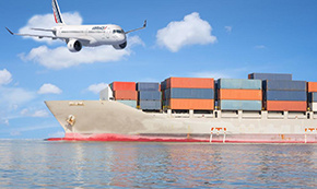
What are the ports on the eastern route? Introduction to World Routes
Categories:
Industry Encyclopedia
Time of issue:
2023-07-06 15:56
The United States borders Canada to the north, the Gulf of Mexico to the south, the Pacific Ocean to the west and the Atlantic Ocean to the east. The coastline is 22,680 kilometers. In terms of routes, the United States is divided into the United States East route and the United States West Route, both of which are basic ports that shipping companies call on to the United States. Other smaller ports and inland points in the United States are all inland points in the United States. Most shipping companies to the United States offer intermodal service to inland points in the United States.
The main shipping companies attached to the East Line are:
MSC, NCL, NORAISA (lower freight rates),
PIL, EMC, COSCO, HPL, APL, ZIM (medium freight rate, fast speed),
CMA, MOSK, MAERSK, HMM, HANJIN, YML (higher freight rate, fastest speed).
East Coast Basic Ports: Houston, Miami, Savannah, New York, Norfolk, Charleston, Jacksonville.

HOUSTON,TX
Located in southeast Texas, on the northwest shore plain of Galveston Bay, it is connected to Mexico by the 80-kilometer maritime Canal. Houston, an artificial port, is now the largest exporter of oil and wheat in the United States, with less throughput than New Orleans and New York.
The port of Houston handles the largest amount of foreign cargo in the United States and the second largest after the Port of South Louisiana when domestic cargo is counted. The Port of Houston also ranks 10th worldwide. In addition to the cargo function, there are numerous oil refineries along the port of Houston.
Houston port area is distributed in the port city to Baytown 25 nautical miles along the canal, there are more than 100 terminals, nearly half of which are public terminals, the rest for oil refineries, chemical plants, steel plants and other factories and mines, as well as grain and cotton export companies and other enterprises special terminals. There are more than 50 general cargo berths in the territory, about 40 of which are owned by the Port Authority, most of which are close to the canal banks near the urban area, and about 30 deep water general cargo berths.
The main container terminal of the port of Houston is located in the Balburg Terminal in the north of Galvoston Bay, about 40 kilometers from the city, with four berths. There is currently only one berth near the city, and the 5th and 6th container berths are under construction. Private general cargo terminals include: 3 berths in Houston terminal and 3 berths in Jacintoh Port Terminal, all of which are accessible by rail. There are five grain export terminals, namely No. 14 and No. 15 of the Port Authority, which can dock two ocean-going ships at the same time. There are 175,000 tons of grain warehouses on the terminals. The same facility is available at the Iquit Export Company Grain terminal; The Gotepasto grain terminal has 300,000 tons of grain storage. The grain terminal has a total grain silo capacity of 800,000 tons, and is the second grain export port in the United States. There are 7 ore terminals with advanced facilities. The oil terminal occupies the first place in the port, with more than 70 berths for oil supply and crude oil distributed along the canal. It is one of the few million tons of ports in the world, among which the international trade volume of goods is 5680 tons.

NEW YORK Harbor NEW YORK,NY
The Port of New York, also known as the "Port of New York and New Jersey", is the largest seaport in the United States, handling more than 5 million Teu per year. The port of New York is located in the northeast of the United States at the mouth of the Hudson River, facing the Atlantic Ocean to the east.
The Port of New York is one of the busiest ports in North America and one of the natural deep water ports in the world. The throughput reached 160 million tons in 1980 and has been above 100 million tons for many years, with an average of more than 4,000 ships entering and exiting each year. In terms of total tonnage, the port is the third largest port in the United States and the largest port on the East coast. Because New York is located on the northeast coast of the Atlantic Ocean, which is the most densely populated and the most developed area of industry and commerce in the United States, and is adjacent to the world's busiest Atlantic airlines, it is close to Europe in position; In addition, the superior port conditions and the connection of the Great Lakes area with the Erie Canal make the Port of New York become the most important product distribution center in the United States, and thus lay its position as an important global shipping transportation hub and the transportation center of Europe and the United States. In the history of New York, the port of New York was at the most critical position. The port not only brought a large number of wealth and products to New York City, but also immigrants from all over the world entered New York City through the port in the early 19th century and the end of the 20th century, and these immigrants and their descendants became the main force of the development of New York City in the future.
There are two bonded zones (foreign trade zones) within the seaports, in which commercial goods (domestic and foreign) receive the same customs treatment as outside the United States.

SAVANNAH,GA
SAVANNAH,GA Commercial port on the east coast of the United States. The lower Savannah River, which meets South Carolina in the southeast of the state, is now the second busiest container port on the East coast. The Port of Savannah is operated by the Georgia Ports Authority (GPA) and competes primarily with the Port of Charleston, the Ports of Charleston and Jacksonville in northeastern South Carolina, and the Port of Jacksonville in southern Florida. GPA operates another Atlantic seaport in Georgia, the Port of Brunswick in Brunswick, Georgia. There are three inland ports connected to the Gulf of Mexico, the Port of Bainbridge, and the Port of Columbus, and one connected by rail to the Port of Savannah at Cordler, Georgia.
The port is about 15 nautical miles from the estuary, and the water depth of the port channel is about 11 meters, which can be reached by 10,000-ton sea ships. Northeast to Port Charleston 111 nm and southwest to Port Jacksonville 150 nm. The port area extends about 9 nautical miles to the northwest along the river from Fort Jackson, where the Savannah River and the Barker River meet. There are more than 50 docks along the river, including the "T" jetty extending into the river and the port pool dug into the land bank. Most of them are distributed on the right bank of the river. There are two oil and dry bulk berths each, which are mainly located in the Ocean docklands downstream and Garden City docklands upstream.
When port congestion hit the West Coast a few years ago, much of the cargo went to East Coast ports like Savannah. Currently, the Port of Savannah has 18 routes to Asia, 16 of which pass through the Panama Canal and 2 through the Suez Canal. Between 2000 and 2005, the Port of Savannah was the fastest growing seaport in the United States, with a compound annual growth rate of 16.5 percent (the national average was 9.7 percent). On July 30, 2007, GPA announced that the Port of Savannah had a record year in fiscal year 2007, becoming the fourth busiest and fastest-growing container terminal in the United States, with GPA setting a new record by handling more than 2.3 million TEU of container traffic in fiscal year 2007 (an increase of 14.5%). Over the past five years, container traffic at the port has increased from 1.5 million TEU in FY 2003 to 2.3 million TEU in FY 2007, an increase of 55%. In response to traffic growth at the ports of Savannah and Charleston, the Jasper Ocean Terminal, which will be the largest port in the country when completed, is scheduled to be built on the upper Savannah River in the mid-2020s.

MIAMI Miami
Commercial Port of Florida, eastern United States. Located in the southeast end of the Florida Peninsula, the Atlantic Biscayne Lagoon Bay, port city to the southeast. It was built in the early 1960s. 813 nautical miles north to New York, 282 nautical miles to Charleston, 210 nautical miles south to Havana, Cuba, and 1220 nautical miles across the Straits of Florida to Colon, Panama. The port terminal is located along two artificial islands formed by filling in the seaside lagoon. The artificial islands are lined up in the northwest and southeast, and are connected to the land by Bridges. Ships enter the port through deep-dug beach canals, mainly loading and unloading containers and groceries, but also vehicles and passengers. All kinds of industrial products, raw materials, wood, newsprint; Export vegetables, tropical fruits, electrical appliances, instruments, etc.

NORFOLK,VA
norfolk,va. Longitude: -76.2858726, latitude: 36.8507689. One of the major inland ports in the United States.
NORFOLK is located in the middle of the Atlantic coast, on the Elizabeth River, at the mouth of the Chesapeake Bay. It is a natural deep water port and a trade port between the Atlantic coast of the United States and the West Indies. The main output of coal, cotton, tobacco, and other industries to shipbuilding warships, ship repair and automobile assembly, NATO Atlantic command is located here, one of the US naval bases.

A commercial Port on the east coast of the United States, located at the confluence of the Cooper and Windu Rivers in South Carolina, where the main railroad from Miami to Washington and New York passes. The port of Charleston is the principal port of South Carolina, 630 nautical miles north of New York, 111 nautical miles southwest of Savannah, 200 nautical miles to Jacksonville, and 1,562 nautical miles to Colon via the Windward Channel.
Port of Charleston Harbor Area
1. Joint Terminal: At the southern end of the port area, there are 4 berths along the shore, mainly used for bulk cargo, with a warehouse area of 87,000 square feet and 30 tons of cranes on the wharf.
2. Columbus Street Terminal: There are 6 berths 1 km north of the Union Terminal, two berths in the south are for containers, the terminal is equipped with 5 40-75 ton loading and unloading Bridges, one banana berth in the north, three bulk cargo berths in the middle, and the terminal is accessible by railway.
3. North Charleston Terminal: 10 kilometers north of Columbus Street terminal, there are 4 berths, with a total length of 762 meters. The north berths are for grain, and there are 1.5 million bushels (more than 40,000 tons) of grain silos on the terminal, the south berths are for general goods, and the two berths in the middle are container terminals with 4 40-ton loading and unloading Bridges.
4. Wendu Terminal: On the east bank of the eastern Wendu River Estuary, there are three container berths with a total length of 740 meters, which were built in the late 1980s. Since the late 1980s, the port's container handling has developed rapidly. In order to meet the needs of container handling, the port authority has built three container berths to the north of Wendu Terminal.

JACKSONVILLE,FL
The port of JACKSONVILLE is located on the north bank of the mouth of ST.JOHNS on the northeast coast of Florida in the southeastern United States, on the west side of the Atlantic Ocean, and is the largest container port on the east coast of Florida. It is a major bulk shipping center in Florida.
Superior geographical location
The port has a superior geographical location, is an important railway hub in the United States, one of the bridgeheads of the continental bridge. It is the main east-west artery of the United States, the eastern bridgehead of the Southern Pacific Railroad, passing through NEW ORLEANS to the western bridgehead of LOS ANGELES. The port is 24km from the international airport and there are regular flights every day.
The Port of Jacksonville is located at the mouth of the St. Johns River on the north coast of Florida in the southeast of the country. Hong Kong faces the Atlantic Ocean to the southeast. The grain is 152 nautical miles north of the Port of Savannah, 200 nautical miles northeast of the Port of Charlestown, 243 nautical miles south of the Florida Straits junction, and 1,502 nautical miles through the Windward Strait to the Port of Cristobal, north mouth of the Panama Canal. The port area is about 22 nautical miles from the inlet and outlet sea, and the inlet channel is 23 nautical miles
The main wharves in Hong Kong are:
1.BLCUNT Island Dock area, on the south bank of the lower triangle island, mainly used for containers, general goods, etc., there are some other docks nearby.
2.TALLEYRAND Port Area, on the left bank of the river, near the urban area, used for loading and unloading groceries, vehicles, timber, containers, steel, coffee and oil, etc.
3. 8 Street pier for loading and unloading vehicles.
4.CONIMCDORE POINT terminal, used for loading and unloading oil, cement, general goods, chemicals.
5. Bulk cargo terminal, with more than 30 berths in Hong Kong, mainly exporting steel products, wood, fuel oil, textiles, paper and pulp, and importing sugar, chemicals, cement, newsprint, coffee, bananas, etc.
The United States shipping card dispatch channel has Meisen Express, star Express, Yantian general ship and other first sea, can receive internal charged, weak magnetic general goods, the end of the delivery to Amazon FBA warehouse.
Us shipping cards are divided into US Haipai and US Haipai.
The advantages of American Shanghai School are direct sea shipping and tail end express. Direct sea shipping is really time-efficient, and tail express can improve delivery efficiency and quickly put the goods into the warehouse.
American sea freight is the first leg of ocean freight to the destination port, and then by truck to the destination. Compared with Haipai, the advantage of Haika is that the logistics cost is low, and the end is delivered by truck, which greatly reduces the freight cost. However, before warehousing, it is necessary to make an appointment in advance.
Logistics Query
Quickly obtain the latest logistics information


Scan code contact
Address: 25/F Room C,Tower A, Honglong Century Plaza, No. 4002 Shennan East Road,Luo Hu District, Shenzhen, China
Zhongshan Address: Room 805, Floor 8 , Poly Plaza office Building, No. 1 Shiji East Road, Port Town, Zhongshan, Guangdong
Changsha Address: 12020, Building 2, Fudi Xingguang Tiandi, Yuhua District, Changsha .,Hunan
Indonesian company:PT VTOP LOGISTIK INTERNATIONAL
Indonesian address:Jalan Pantai Indah Barat Komplek Toho Blok A No 18 ,Kec.Penjaringan,Kel.Kamal Muara,Jakarta Utara

WeChat ID
Scan code contact